 |
dr hab. Agnieszka Herman Instytut Oceanografii Uniwersytet Gdański Al. Piłsudskiego 46, 81-378 Gdynia Email: oceagah@ug.edu.pl Tel: +48 (0)58 5236887 Fax: +48 (0)58 5236678 Curriculum Vitae |
   0000-0001-5112-7165 0000-0001-5112-7165
|
|
dr hab. Agnieszka Herman Instytut Oceanografii Uniwersytet Gdański Al. Piłsudskiego 46, 81-378 Gdynia Email: oceagah@ug.edu.pl Tel: +48 (0)58 5236887 Fax: +48 (0)58 5236678 Curriculum Vitae |
0000-0001-5112-7165
|
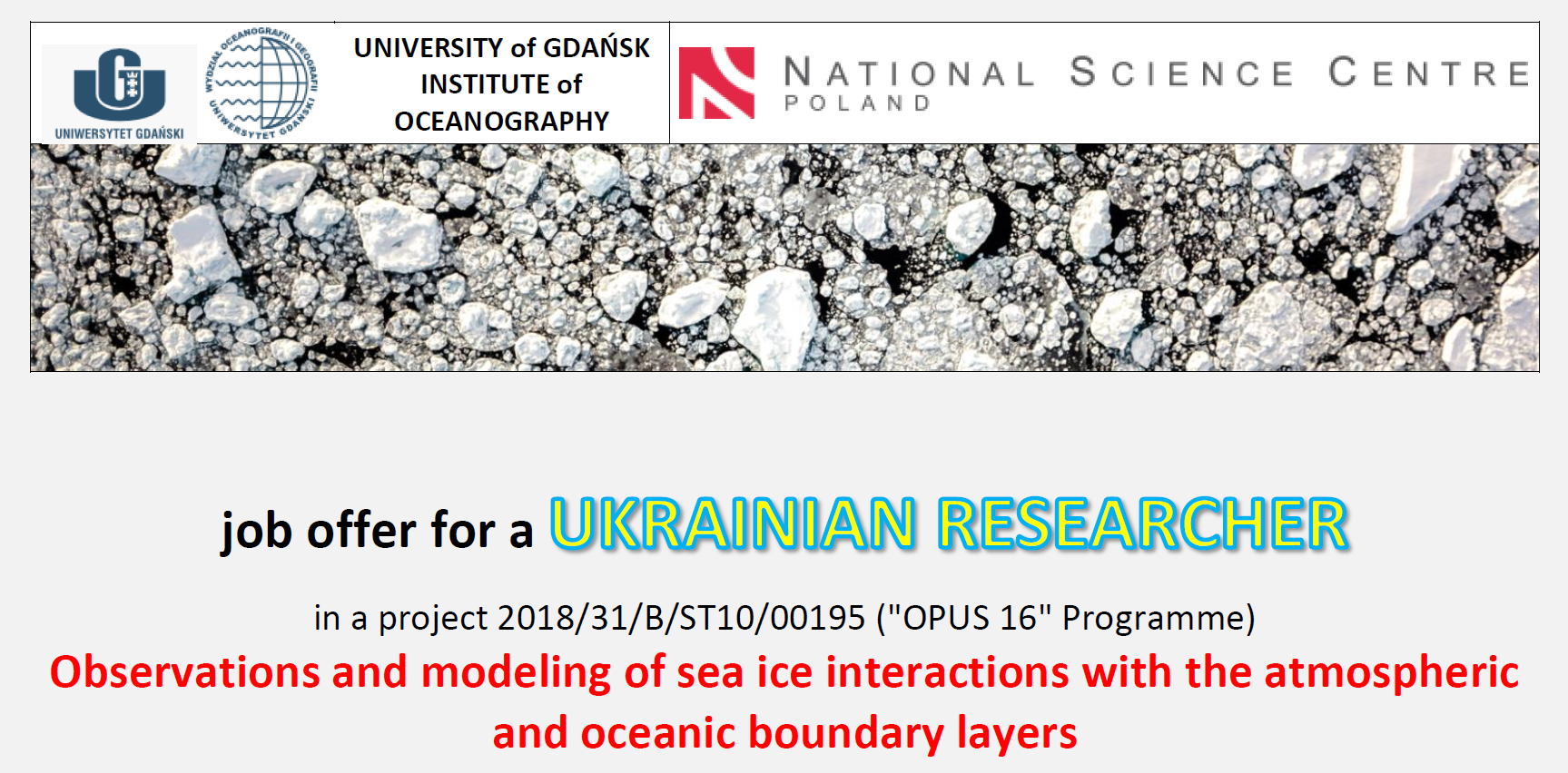
Oferta pracy w naszym projekcie dla naukowca z Ukrainy!
Szczegóły u kierownika projektu i tutaj:

Herman, A., Wenta, M., Cheng, S., 2021. Sizes and shapes of sea ice floes broken by wavesA case study from the East Antarctic coast, Frontiers Earth Sci., 655977, doi: 10.3389/feart.2021.655977 (paper).
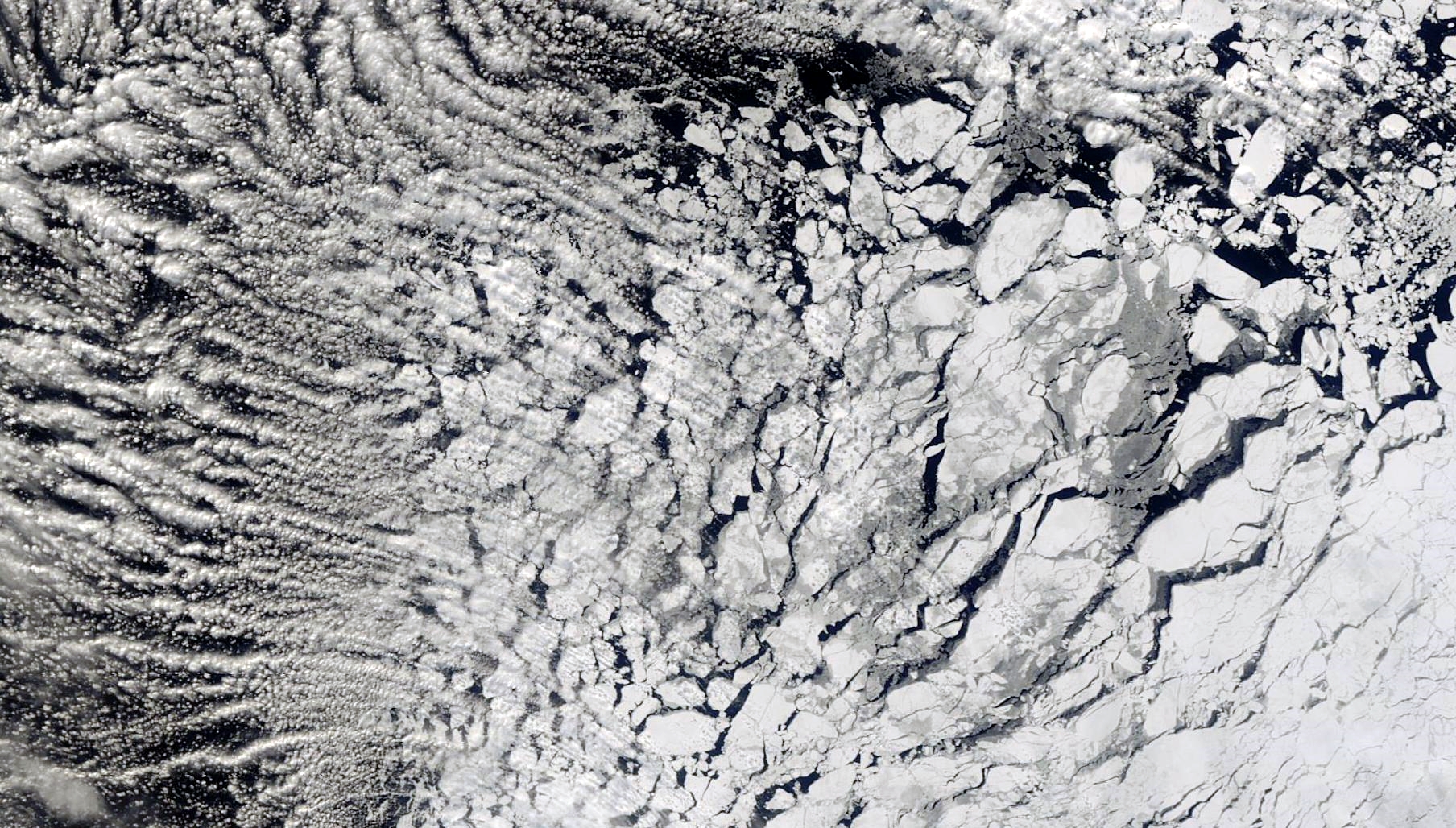
Abstract: The floe size distribution (FSD) is an important characteristics of sea ice, influencing several physical processes that take place in the oceanic and atmospheric boundary layers under/over sea ice, as well as within sea ice itself. Through complex feedback loops involving those processes, FSD might modify the short-term and seasonal evolution of the sea ice cover, and therefore significant effort is undertaken by the scientific community to better understand FSD-related effects and to include them in sea ice models. An important part of that effort is analyzing the FSD properties and variability in different ice and forcing conditions, based on airborne and satellite imagery. In this work we analyze a very high resolution (pixel size: 0.3 m) satellite image of sea ice from a location off the East Antarctic coast (65.6°S, 101.9°E), acquired on February 16, 2019. Contrary to most previous studies, the ice floes in the image have angular, polygonal shapes and a narrow size distribution. We show that the observed FSD can be represented as a weighted sum of two probability distributions, a Gaussian and a tapered power law, with the Gaussian part clearly dominating in the size range of floes that contribute over 90% to the total sea ice surface area. Based on an analysis of the weather, wave and ice conditions in the period preceding the day in question, we discuss the most probable scenarios that led to the breakup of landfast ice into floes visible in the image. Finally, theoretical arguments backed up by a series of numerical simulations of wave propagation in sea ice performed with a scattering model based on the Matched Eigenfunction Expansion Method are used to show that the observed dominating floe size in the three different regions of the image (18, 13 and 51 m, respectively) agree with those expected as a result of wave-induced breaking of landfast ice.
Herman, A., 2021. Spectral wave energy dissipation due to under-ice turbulence, J. Physical Oceanography, 51, 1177-1186, doi: 10.1175/JPO-D-20-0171.1 (paper).
Abstract: Dissipation within the turbulent boundary layer under sea ice is one of many processes contributing to wave energy attenuation in ice-covered seas. Although recent observations suggest that the contribution of that process to the total energy dissipation is significant, its parameterizations used in spectral wave models are based on fairly crude, heuristic approximations. In this paper, an improved source term for the under-ice turbulent dissipation is proposed, taking into account the spectral nature of that process (as opposed to parameterizations that are based on the so-called representative wave), as well as effects related to sea ice concentration and floe-size distribution, formulated on the basis of the earlier results of discrete-element modeling. The core of the new source term is based on an analogous model for dissipation due to bottom friction derived by Weber in 1991 (https://doi.org/10.1017/S0022112091003634). The shape of the wave energy attenuation curves and the frequency dependence of the attenuation coefficients are analyzed in detail for compact sea ice. The role of floe size in modifying the attenuation intensity and spectral distribution is illustrated by calibrating the model to observational data from a sudden sea ice breakup event in the marginal ice zone.
Wenta, M., Brus, D., Doulgeris, K., Vakkari, V., Herman, A., 2021. Winter atmospheric boundary layer observations over sea ice in the coastal zone of the Bothnian Bay (Baltic Sea). Earth System Science Data, 13, 33-42, doi: 10.5194/essd-13-33-2021 (paper).
Abstract: The Hailuoto Atmospheric Observations over Sea ice (HAOS) campaign took place at the westernmost point of Hailuoto island (Finland) between 27 February and 2 March 2020. The aim of the campaign was to obtain atmospheric boundary layer (ABL) observations over seasonal sea ice in the Bay of Bothnia. Throughout 4?d, both fixed-wing and quad-propeller rotorcraft unmanned aerial vehicles (UAVs) were deployed over the sea ice to measure the properties of the lower ABL and to obtain accompanying high-resolution aerial photographs of the underlying ice surface. Additionally, a 3D sonic anemometer, an automatic weather station, and a Halo Doppler lidar were installed on the shore to collect meteorological observations. During the UAV flights, measurements of temperature, relative humidity, and atmospheric pressure were collected at four different altitudes between 25 and 100?m over an area of ~1.5 km2 of sea ice, located 1.11.3 km off the shore of Hailuoto's Marjaniemi pier, together with orthomosaic maps of the ice surface below. Altogether the obtained dataset consists of 27 meteorological flights, four photogrammetry missions, and continuous measurements of atmospheric properties from ground-based stations located at the coast. The acquired observations have been quality controlled and post-processed and are available through the PANGAEA repository (https://doi.org/10.1594/PANGAEA.918823, Wenta et al., 2020). The obtained dataset provides us with valuable information about ABL properties over thin, newly formed sea ice cover and about physical processes at the interface of sea ice and atmosphere which may be used for the validation and further improvement of numerical weather prediction (NWP) models.
Herman, A., Dojczman, M., Świszcz, K., 2020. High-resolution simulations of interactions between surface ocean dynamics and frazil ice, The Cryosphere, 14, 3707-3729, doi: 10.5194/tc-14-3707-2020 (paper).
Abstract: Frazil and grease ice forms in the ocean mixed layer (OML) during highly turbulent conditions (strong wind, large waves) accompanied by intense heat loss to the atmosphere. Three main velocity scales that shape the complex, three-dimensional OML dynamics under those conditions are: the friction velocity u* at the ocean--atmosphere interface, the vertical velocity w* associated with convective motion, and the vertical velocity w*,L associated with Langmuir turbulence. The fate of buoyant particles, e.g. frazil crystals, in that dynamic environment depends primarily on their floatability, i.e., the ratio of their rising velocity wt to the characteristic vertical velocity, dependent on w* and w*,L. In this work, dynamics of frazil ice is investigated numerically with a high-resolution, non-hydrostatic hydrodynamic model CROCO (Coastal and Regional Ocean COmmunity Model), extended to account for frazil transport and its interactions with surrounding water. An idealized model setup is used (a square computational domain with periodic lateral boundaries; spatially uniform atmospheric and wave forcing). The model reproduces the main features of buoyancy- and wave-forced OML circulation, including the preferential concentration of frazil particles in elongated patches at the sea surface. Two spatial patterns are identified in the distribution of frazil volume fraction at the surface, one related to individual surface convergence zones, very narrow and oriented approximately parallel to the wind/wave direction, and one in the form of wide streaks with separation distance of a few hundreds meters, oriented obliquely to the direction of the forcing. Several series of simulations are performed, differing in terms of the level of coupling between the frazil and hydrodynamic processes: from a situation when frazil has no influence on hydrodynamics (as in most models of material transport in the OML) to a situation when frazil modifies the net density, effective viscosity, transfer coefficients at the ocean--atmosphere interface and exerts a net drag force on the surrounding water. The role of each of those effects in shaping the bulk OML characteristics and frazil transport is assessed, and the density of the icewater mixture is found to have the strongest influence on those characteristics.
Krótki film reklamowy
Dane obserwacyjne, dostępne w serwisie Pangaea